
www.rambler-info.org.uk - limitations of information supplied

"Websites are usually written by someone you have never met"
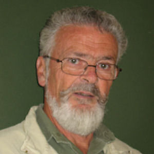
I bought my first GPS some time in the last millennium. In the year 2000, when I retired, I was upgraded to a fancier model and started to ask more questions.
Each of the pages on this website was written after I had found an answer to a problem or an interesting puzzle. It seemed like a good idea to record the answer, in the hope that anyone with similar interests might find it by using a search engine.
Nearly all of the pages are being edited. Usually to incorporate improvements, but occasionally to correct errors. Note that last part please!
I walk a lot in the UK with friends and I always record the walks using a GPS. The walks get downloaded to the computer that evening. We average about two walks per week. I have a lot of GPS tracks! Many of them are identical. As a result I have gained some insight to such matters as how the annual growth of leaves on trees will make the GPS less accurate.
Also I now own some digital maps of the UK. I have both the 25k Memory-Map of the Peak Park and the Tracklogs equivalents, I have a 50km by 50km square of Tracklogs 25k map centered on Loughborough and the 50k National Parks map from Anquet. The 25k maps are regularly used to plan routes on a computer, to print maps and to download to a GPS to be carried on walks.
I also organise a walking group that does seven pairs of Peak Park walks each year. Rather unusually, all these walks are planned and documented in the previous winter. Most are now lead by someone other than the two authors of the routes. This has resulted in walk leaders being handed a GPS with the track loaded and running - an interesting study of people's reactions!
Since retirement I have been lucky enough to lead walks for a commercial walking tour company. While doing this I have collected some GPS data in a wide range of locations and had a chance to navigate using some foreign maps.
I have always thought that the best application of a handheld GPS should be to pass walking route information between people. Working with this tour company brings me close to a serious implementation of this. Certainly I have investigated several strategies. I can see the need to get it right by proceeding cautiously with its implementation.
I would like you to see similarities between you and me. I have been doing this for a hobby for some while now and I like to share my findings. If you spot any mistakes please tell me. Also, if you have any current puzzles, I would probably be happy to join with you in a search for the answers.
There is a way in which you can contact me without either of us getting our email address into the hands of spammers.